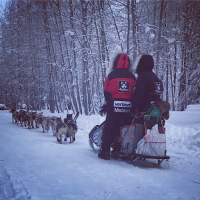
This morning Allen and 12 team mates left Dawson for the 150 miles to Eagle. He left with a laden sled and straw ready to stop and camp along the way. The dogs and musher were ready to hit the trail again and the dogs let out a howl of delight as they were hooked up to the line ready to leave.


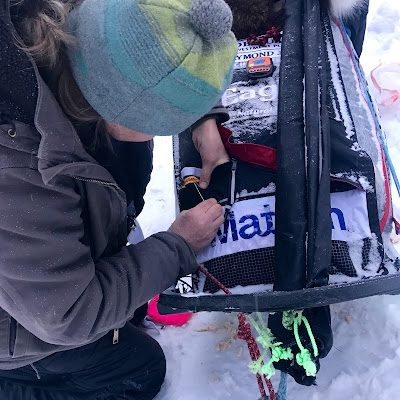
Bridgett has a moment with Chipper; Brianna from the Logistics Team reattaches the Spot Tracker
Allen left Nomex with us to come home in the truck. He worked so, so hard climbing up in the Black Hills and King Solomon’s Dome that he pulled up with a sore tricep. Allen carried him the last 20 miles, or so, into Dawson and had hoped with some rest he might be able to carry on. It was decided that although he looked okay, Allen would rather not risk taking him and a) turn a ‘tweak’ into a serious injury and/or b) have to carry him up American Summit.
While Allen and Bridgett packed the sled with supplies for 150 miles (plus contingency), Mark changed runner plastics and filled the fuel can and Aliy and I readied the dogs. Each of us had a specific job which made the whole process really efficient. We dressed the dogs in their puffy (insulated) wind jackets and packed foxtail “personal area protectors” for the boys in anticipation of the cool wind out on the rivers and as they head north.
Leading the team out of Dawson was Commando and Mismo, Junior and Dutch were in swing, Spark and Izzy, Kodiak and Amber, Rodney and Champ with Chipper and Felix in wheel.


Mismo is ready; Aliy hitches a lift to the start line
The Mushers Guide to the YQ Trail says of this next leg: “The next 50 miles from Dawson are on the Yukon River. The first 20 miles are usually fairly fast and smooth—likely to be overflow at the mouth of the 15 Mile drainage. The trail crosses back and forth across the Yukon and may use several bush trails for short distances, depending on ice conditions. The 40-mile hospitality stop is a long 50 miles most years. This is a good place to stop; adequate parking. A few miles farther on is another hospitality stop at Clinton Creek — just up the 40 Mile River by the bridge.
Leaving the old town of 40 Mile; you turn immediately onto the 40 Mile River; you will be on the 40-Mile for 45 miles. It is a narrow, winding river that is most often cold because of the deep canyon with little sun. The trail usually is very good unless there has been a recent heavy snow—then expect overflow. You will be leaving the river at the Taylor Highway MP 113 crossing. You climb up the boat ramp on the left bank, turn right on the highway which is not plowed during the winter months. Crossing the bridge it is 49 miles to the checkpoint of Eagle at MP162. Highway running on good trail, with lots of ups and downs for this section.
Your first potentially windy summit of the trail is American Summit; if it’s breezy in the trees below the summit expect possible whiteout conditions on top. You begin your climb just past milepost 135 and will get above timber a few miles further on. The summit is almost always side-hilled and badly sloped. Trail markers can be frosted over, even in the wind. Expect the full range of alpine conditions from hard, drifted snow to soft team swallowing drifts. You are on top for about 3 miles before beginning your 17 mile descent to Eagle. The long gradual descent is mostly uneventful; you will encounter some potentially nasty overflow stretches as you near the town of Eagle; the worst of them between 4-8 miles out.“
The trail report in the musher meeting yesterday said that for the first little while the teams will mush on the frozen centre of the Yukon River and will have open water on both sides of them, just 15-20 feet away. Yikes!
We’re excited to see them back on the trail and look forward to catching them once they are back in Alaska! In the meantime we have camp to break down and a loooooooooong drive. More on that later.


